Showing posts with label Dalton Hwy. Show all posts

Friday, November 6, 2015

Gates of the Arctic National Park & Preserve, Alaska - Autumn in August

In mid August 2015, I headed north, the far north, above the Arctic Circle to explore the Gates of the Arctic National Park & Preserve. It had been almost 3 years since I was there last. I wanted to explore and photograph more in depth this time... The Gates of the Arctic National Park & Preserve is true remote wilderness, it is hundreds of miles away from civilization, and the weather and environment can be harsh. Only a handful of people venture into the area during the short summer season. There aren't any visitor facilities or established trails, so you have to be very self-sufficient.

It was gray and rained constantly since leaving Anchorage and while passing through Denali and Fairbanks... It was typical weather in Alaska during August. When I crossed the Yukon River and made it to the Arctic Circle, it was raining hard... Camping in cold rain isn't my favorite! It was raining on and off all the next day driving through the Dalton Highway along the Brooks Range. This remote wilderness seems depressing in the dark overcast weather. Autumn was already in the air here in the Arctic north in mid August! The brilliant fall colors were at least brightening us up. The rain got harder when we finally arrived at the Gates of the Arctic and Arctic National Wildlife Refuge area... and it was drenching overnight till late the next morning!

Finally, the rain slowed down in late morning as three of us packed up camp and prepared for several days backpacking into the park. Starting at the Dalton Highway, we crossed the icy cold Dietrich River then climbed up the brushy tundra hill for a few hours. It was a long steep climb with heavy packs. Reaching the flat area of the mountain ridge, we officially entered the National Park boundary. Clouds were gathering above us while we walked across the marshy tundra on the ridge... and a stormy rain began to fall! We put on rain jackets and pants, and covered up our packs in the stormy wind. Sadly, the rain turned to hail! After we were wet and cold, the sun came out and brought up multiple rainbows over the mountains. We traversed through the wet and marshy tundra covered mountain till finally we descended down towards Kuyuktuvuk Creek. It was much harder than backpacking on established trails... The three of us set up base camp at the creek that night.

It was at least partly sunny the next day. We hiked along the creek with daypacks only and camera gear for me. The fall colors in the tundra were colorful in this Arctic region - red, orange and yellow patchwork! The colors really stood out in the sunshine!

 A skull from a Dall Sheep was found on the tundra hill... The place was truly wild, away from towns, no phone signals, and no other people besides the three of us... If something tragic happened, there wasn't any way to call for rescue and our bodies weren't going to be found for years, just like this sheep.

Waking up the next morning surprised us with snow! The mountain pass was snow covered while raining in camp... It was still the middle of August! We decided to shorten the trip and headed back. To get back to where we started from, we had to climb up the steep tundra mountain with snow on the ridge... Climbing up the slippery tundra hill in rain was pretty demanding, and as we climbed higher the rain turned to snow... The mushy tundra ridge was snow covered, as more snow fell... It was cold, wet, and miserable... I just had to keep walking. I regretted not capturing the snowy landscape, however, I lost any motivation to do any extra work besides walking to get out the area...

Better weather was waiting for us at the other side of mountain ridge. No more snowing, and sunshine! Finally, I took out my camera. The vast landscape with endless mountain scenery was amazing... Hundreds of thousands of miles of untouched wilderness! Dalton Highway and Pipeline was the only human evidence in the area. This remote Arctic North is truly beautiful, but at the same time, I sensed nature's brutal power.


Here are the some more images from the Arctic North...
Beginning of the Dalton Highway.

Breathtaking sunset at the Yukon River.

Old mining town of Wiseman. This old cabin is a museum now.

More images from Alaskan wilderness will be in the next posting. Please check back!


Sunday, October 14, 2012

Gate of the Arctic National Park & Preserve, Alaska

Continued from the last posting, I was exploring the Arctic north...
After progressing up to Deadhorse (Prudhoe Bay), it’s time to explore in the Gate of Arctic National Park & Preserve on foot.  The 3-day backpacking trip began with crossing icy cold Dietrich River. Soon after I put dry shoes back on, a long steep ascent weaved before us...  The tundra-covered hillside angled almost straight up to the ridge...  In this undeveloped National Park, there aren't any systematic trails. Hikers have to find own way and navigate with a map and compass. After only a few hours of climbing, the valley with the Dalton Hwy and Dietrich River sprawled far below me!  The entire valley and the mountains above were lighting up with warm afternoon sun.


The wide unfolding ridge was almost flat, covered with tundra and numerous tiny streams.  I found a perfect Zen garden among the autumn tundra.


The Arctic is the land of the ceaselessly migrating Caribou.  The fallen off antlers were naturally discarded on the tundra all over this area...

The first night’s camp was on the ridge, overlooking the Kuyuktuvuk Creek Valley. The clouds rolled in and it rained all night.
Fortunately, the rain stopped the next morning. Slowly climbing down to the creek, into the valley with colorful fall colors, I was amazed this pristine dramatic scenery where only a few people had ever visited. I spotted a fresh bear dropping, the skull of Dall Sheep, the skin of Caribou, but never saw any large wildlife except an oversized porcupine.  Walking on the ancient glacial moraine, gully, crossing the swift Kuyuktuvuk Creek, and hiking up to the tundra hillside for the entire day.  As I hiked along Kuyuktuvuk Creek to upstream, the landscape was changing drastically; less vegetation with rocky terrain.  Snow dusted mountains were towering above, and the rushing creeks became narrow and shallow streams.  When I reached Oolah Lake, the air was different, much colder than the ridge I awoke on in the morning!

After breaking camp near Oolah Lake, I retraced our steps back along Kuyuktuvuk Creek. I climbed back to the steep hillside, walked across the wide boggy ridge, and descended straight down to Dietrich River for one full day. The whole area was truly magical, I was in the beautiful Arctic dream.

Thursday, September 13, 2012

Arctic Alaska

"Far North" - north of the Arctic Circle – above the latitude 66°33′44″ North, the remote wilderness of Brooks Range to Arctic Ocean – an area I have found fascinating for over 10 years since my first summer in Alaska.  This part of Alaska is the land of the midnight sun - sun stays above the horizon for 24 hours at the summer solstice, vegetation grows fast under the perpetual light, and wildlife - bears, caribou, moose, and wolves are always busy feeding and reproducing during the short summer. The only road across the remote Arctic is the 414 mile Dalton Highway from Fairbanks via Steese Hwy and Elliot Hwy, a total of 500 miles to Prudhoe Bay (Arctic Ocean), 850 miles from Anchorage!
In mid August, while it was still late summer in Anchorage, my journey to Arctic began.  Passing through Fairbanks, 350 miles from Anchorage, the fall was already starting!  The birch woods were turning to yellow. 84 miles from Fairbanks, the Dalton Hwy started with dirt road and a lot of construction.  After crossing the Yukon River, the highway follows the pipeline to the north.  The Birch woods changed to the land of permafrost with boreal forest.  The open tundra was already a golden fall color when I entered the Arctic Circle.  Countless rivers and lakes lay scattered across the open valley.
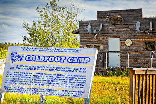
The historic gold rush town Coldfoot is now a big truck stop for huge trucks which heading to/from North Slope oilfield.  This is a last place for gas and supplies until Deadhorse, on the north end of Dalton Hwy.
The highlight of the Dalton Highway is north of Coldfoot; the spectacular Brooks Mountains begin. Gate of Arctic National Park & Preserve, Arctic National Wildlife Refuge, and some other protected lands are laid along the highway.  The colors of the tundra was vibrantly painted in orange and red, glowing in the nearly everlasting autumn sun.
Crossing Atigun Pass, the rivers north of the pass flow into the Arctic Ocean, and the rivers in the south flow into the Pacific Ocean. The dramatic scenery - rugged mountains and tundra valley continues on.
It was an emotional moment when I finally saw the edge of Arctic National Wildlife Refuge after signing so many petitions to protect this pristine remote land from oil development for the past years.  When I first heard about this area and the issue, I was still young, maybe a teenager in Japan, but I was strongly moved and felt pain for the political issue.  Finally I was there, seeing the evening light shine down upon the rugged mountains and the valleys from the Dalton Hwy...  The landscape of the refuge is stunning. I hope this area will be permanently protected for future.
Caribou crossing the tundra on north of Brooks Range.
The darkness of night lasts for at least a few hours...  The northern lights start dancing the Arctic.
To be continued to the next posting...